PHOTO
A new local history book, produced by the Orange and District Historical Society, explores some of the earliest maps and sketches of Orange and brings to life the stories of the surveyors and cartographers who created them.
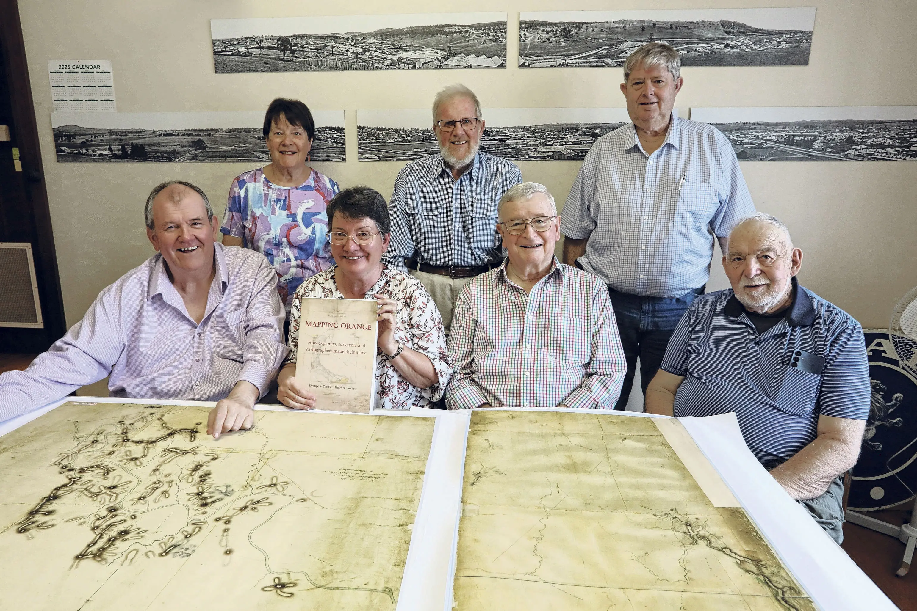
‘Mapping Orange: How explorers, surveyors and cartographers made their mark’ is the result of two years’ work by members of the local historical society, who have each written a chapter examining the history of European explorers, surveyors and cartographers in the Orange District.
And it all came about due to an argument about a pub, according to Historical Society member Liz Edwards, who edited the book as well as being a contributor.
“Jim Coffey and Rob Bartlett they were having an argument about an inn called ‘Mills Inn’, which is in West Orange, about where exactly this inn was,” recalled Liz.
“Jim was convinced, there must be another map and just as they were trying to work out where this place was, Judy, one of our members, was going through all these drawers looking for things and she brought out this copy of a map and asked, ‘Is this worth keeping?’ And it was the other part of the map that they were looking for.
“So it sort of all started from there and then we all got interested in various parts of this research.”
The book brings together for the first time previously little-known information about the early origins of the settlement that became Orange, including settling the often confused origins of the townships' original name.
“In 1823, there was a man called John Blackman, who was the police constable at Bathurst and he was asked to help a group, including Lieutenant Percy Simpson, find a route from Bathurst to Wellington,” Liz explained.
“Blackman's Swamp, which was Orange's original name, was named after John Blackman, but over the years the story got changed, and some people said it was his brother James Jnr or his father, James Snr. But Bob Curran who did that chapter, has more or less proved that it had to be John Blackman.”
The book takes a detailed look at a number of early maps of Orange and the surrounding district, the surveyors who made them and even the equipment and techniques they had at their disposal.
“Jim Coffey has done a remarkable chapter on a map that one of the surveyors called Davidson made in 1846 and it shows the square mile that had been surveyed where the village of Blackman’s Swamp was to be… and, he's found out all the stories of the people who were living here at the time who were not known to us,” Liz said.
“And then, I've done a chapter on what we call the Wellwood Map… it's a very early map of what they called Frederick's Valley, sort of the road between Orange and Lucknow. It's got various bits of written information on it, so it's quite a good piece of evidence about who was living there at the time.”
The book also includes a very detailed account by member Euan Green on the naming of Gaanha Bula - Mount Canobolas, having delved into numerous old maps, records and early accounts.
“And then Julie Sykes has done a chapter on the early development of Orange when it became the village of Orange and how very quickly the streets were laid out, and people started buying blocks of land, and prominent buildings were erected in a very short space of time,” Liz added.
As expected, the book included reproductions of many early maps of Orange, as well as historical illustrations and photographs. There is also a remarkable timeline of Gaanha Bula - Mount Canobolas stretching back millions of years, to when the mountain was an active volcano.
Mapping Orange: How explorers, surveyors and cartographers made their mark will be officially launched at Orange City Library on Thursday, November 20 from 5pm - 7pm. All welcome.
Copies of Mapping Orange will be available for sale on the night for $40 each, supported by Collins Booksellers. The book will also be available for purchase from the Orange & District Historical Society.